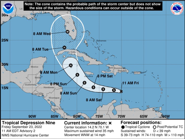
Tropical Depression Nine has developed over the Caribbean Sea about 450 nm ESE of Kingston, Jamaica and is moving WNW at 12 kts with max winds of 30 kts. Moderate to strong wind shear is expected to persist through tonight, so only slight strengthening is forecast through early Saturday. During Sunday the cyclone is forecast to turn northwestward and northward as it approaches western Cuba early next week. Thereafter, models diverge significantly bringing the system anywhere pan from the eastern Gulf to east of the Florida peninsula.
The NHC forecast calls for rapid intensification as the cyclone crosses the northwestern Caribbean Sea and likely will be a strengthening hurricane as it approaches the Cayman Islands and Cuba. Early next week the system is forecast to move near or over western Cuba and then approach the Florida peninsula at or near major hurricane strength, with the potential for significant impacts from storm surge, hurricane-force winds, and heavy rainfall.
Latest NHC Update: https://www.nhc.noaa.gov/graphics_at4.shtml?start#contents