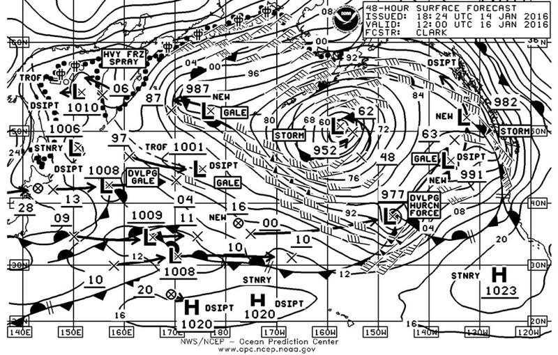
A strong 500MB jet lies west to east across the North Pacific south of 40N latitude and will cause a developing hurricane force storm to develop over the central North Pacific shipping lanes over the next 2-3 days. http://oceanweatherservices.com/blog/2016/01/11/central-pacific-hurricane-force-storm-forecast/
Update: A developing gale low over the western North Pacific, east of Japan will deepen rapidly over the central North Pacific reaching 958 MB by 00z/14th and 949 MB by 00Z 15th. This will be a dangerous storm as it travels ENE across the primary North Pacific shipping lanes.
North Pacific Storm Update
A quick update this morning - The developing storm over the central North Pacific is still forecast to reach 948 MB over the next 18-24 hours with winds increasing 65-90 knots and seas building over 16 meters (52 feet) within 240NM west and south of the center. By 00Z/15th seas may build as high as 18 Meters (59 feet).
Dangerous North Pacific Storm Packing 90 knot winds

Thursday update: 
From Kamchatka to the Coast, it sucks everywhere. Glad to be ashore right now.


