
Noting that the hull damage is likely resting against the sea bed, would it be feasible to try to patch the holes from within the flooded tanks?
You will have to make an opening in the hull. I suppose that can be done with the right material. Another possibility is to suck the sand from underneath the damaged area which is resting on the sea floor and try to close the opening from the outside.
The AIS is still working so their must be a generator operational.
Position Received: 2020-03-07 12:28 UTC
4 minutes ago
Vessel’s Local Time:
2020-03-07 09:28 LT (UTC -3)
Possible.
If not, they could have put a mobile AIS-unit on the ship, for security reasons.
The AIS-status of the vessel is given as ‘Not Under Command’.
Yes, having a mobile on board working on batteries is more logical then having a generator running for just that purpose. However, you will have to replace the batteries on a regular basis.
A reason for having a generator on is the perishable stuff like meat and fish cooled or frozen. If not then that will be getting a bit smelly by now in that climate…
When I looked yesterday, on MarineTraffic ‘Stellar Banner’ was displayed as ‘by satellite’ and VesselFinder showed her as ‘R4ellar Banner’.
May be when they installed a mobile unit…
Interesting case. I assume ship had pilot aboard and contacted something in the fairway ripping open the hull, starting with the fore peak and then the single hull starboard side (ballast) tanks.
Up-flooding the fore peak means the ship trims on the bow, up-flooding one or more starboard side ballast tanks means ship heels starboard.
So the Master managed to run up on a sand bank. I wonder how many tanks are up-flooded.
The most obvious way to unload her would be to use a big dry cyclone or two to offload onto barges. I can see that happening fast enough to avoid banging around through several high tides, avoiding further hull damage. Now where might one find a mobile cyclone system of sufficient capacity? Wait, isn’t that what’s called a suction dredge?
No! More obvious is to temporarily repair the damaged hull and re-float the ship.
The VLOC Stellar Banner ran aground due to a navigational error?
Watch the video with A.I.S. tracking on the vessel when it ran aground.
So it seems the ship with draught (depth of water to float a ship) 21.5 m at departure contacted the seabed at 20 m depth in the fairway, etc. The result was underwater hull structural damages, up-flooding, loss of buoyancy and then a grounding, thanks to the Master running the ship up on a sand bank. Nobody died.
What to do now? Just seal the hull damages from outside, pump out water from damaged hull compartments and proceed to a port to discharge the cargo.
Then dry-dock the ship and permanently repair the hull!

The Stellar Banner has a compulsory VDR on board. The ship’s route can be accurately reconstructed from the data on that machine. That will show what really happened. It could be that the ship ran aground and stopped there in its track. If so the earlier statements that the ship was purposely put aground would be wrong. The position of the ship, which is evenly supported over the full length by the sandbank, suggests that. We will have to wait and see…
In the mean time they should make a survey of the area with a side scan sonar or hydrographic echosounder and look for obstacles. Also sandbanks are known to move in time.
Interesting! M/S Stellar Banner proceeds at 12.6 knots and contacts a sand bank … and rips open the fore peak and the starboard hull/tanks behind the collision bulkhead, etc. And after a while - details unknown - the heeling ship comes to rest on another sandbank under own power. Nobody is hurt. No pollution! Engine is stopped!
The ship has not sunk! It has only grounded. I assume the engine room is intact. So what is the problem?
At video second around 43", you can see the ship’s course and the pair of the ultimate buoys, 3+4 and 1+2, of the access channel, some 30 degrees to port of the buoy direction before. The vessel continued straight forward!
This says strictly nothing about the incident. Did the ship not follow the channel and then touched bottom, or did she touch something on the bottom before, and inside the channel, then healed, and went to a sandy region to ‘seek’ the bottom?
Even on an extremely heavy vessel like this one, the VDR should show the ship’s deceleration, when the bow section was ripped open for 25 meters… I think.
I was commenting on the feasibility of unloading in situ, and wouldn’t pretend to understand how to untangle this mess, especially not from here. I don’t think the salvage engineers on the project are forming very strong opinions either, without first considering a whole bunch of specifics unknown to us.
The huge oceanic tug ‘Alp Defender’, coming from Port-Gentil / Gabon, is now waiting or anchored near ‘Stellar Banner’.
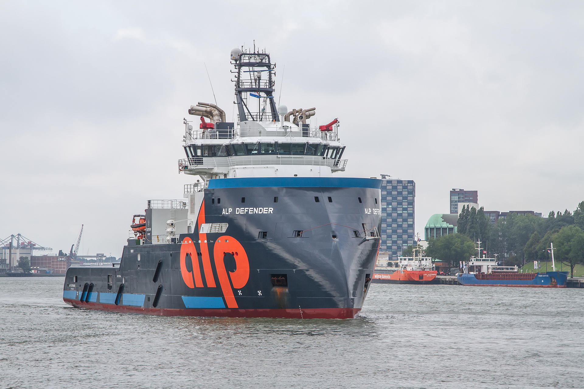
Dutch tug Alp Defender with 305 mt continuous bollard pull.
Maybe someone knows what this big tug could do there.
I don’t speculate anymore how the salvagers could proceed… they always come up with surprising ideas…
Ardent Global has a huge salvage experience; it is a merger of two offsprings:
Crowley’s Titan Salvage (e.g. Costa Concordia) and Maersk’s Svitzer Salvage.
I was also wondering about this. I don’t suppose that they are going to tow the bulker to deeper water…
The ship is lying sand locked on a course of 250°, we will see if that changes.
The course has changed! What’s going on? Freeing the bow area?
Speed/Course: 0 kn / 98 °
Is that the course or heading? Course might jump around by gps jitter.