
Yes, the reliability of the system can’t be judged by looking at each element alone. A paper chart is very reliable, as are pencils, triangles, dividers etc. But a mate, facing aft, bent over the chart table using those tools, not so much. Especially, as has been pointed out, if they are just transferring GPS positions to the chart.
As long as print on demand is still available, I’ll be happy.
ELECTRONIC CHARTS CAN BE HACKED - - - - bottom line - - end of story
I disagree with your statement. This is not about economics. There is no reasonable plan available for transition for a LARGE number of vessels, from paper charts to “whatever”.
If your electronic chart can be ‘hacked’ you’re a poor navigator. It’s a chart. If someone were to ‘hack’ it, I’d notice instantly because I’m not a shitty navigator.
Poor navigation practices are poor navigation practices. Refusing to follow best practices with the best tools available is poor navigation.
Nothing has changed, there’s just new excuses to old problems. There’s something to be said for traditions breeding quality seamanship, but those traditions have to incorporate best practices.
There’s a new constellation of satellites that can give you precise nav data instantaneously, and there’s thousands of them. If you’re not bothering to learn how, you’re not committed to good navigation, you’re committed to posturing.
WOW - - you said a lot without knowing anything about my skills and experience
Thanks for the comment, though!
What drivel.
DGPS was created to remove the offset deliberately put in by the US.
If an offset can be put in by a friendly Government then it can be put in by an unfriendly one and it doesn’t matter what sort of smart arsed navigator you are, if the base information that you are forming your decisions on is flawed then you can get in trouble quite quickly.
Luckily you are obviously on watch 24 hours a day to make sure nothing goes wrong.
We’re told that anything and everything can be hacked so presumably GPS signals can be rendered useless by a bad actor. That alone makes the continuation of printed paper charts on demand important.
When we were using paper charts almost all the mates were steering by the “Highway” display on the GPS anyway.
When they did plot the required fix on the paper chart they mostly just read the position off the GPS and plotted that. Never mind a quick radar bearing and range sometimes is faster and easier.
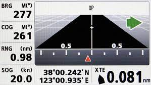
Bearing and ranges can be plotted on an ECDIS. The fix is displayed along with a GPS fix at the same time and a record is kept on a electronic log.
There always seems to be some confusion in these threads between real time GPS position updates on an electronic chart and the fact that it’s still a chart.
You can use all of the techniques you use on paper charts on an electronic chart, just faster and easier with more accuracy and better situational awareness.
The ability to quickly restore satellite position information is a different issue. That’s also important - inclement weather can render traditional navigation techniques impossible. Everyone with any experience at all has seen that. I guess nature hacked your paper charts after all.
It would be fun to be transported to the wheelhouse of one of the paper charts proponents in a zero visibility white out with the radar screen blanked out and watch them shit their pants when their plotter goes down and they don’t know how to fix it/they don’t have multiple back ups.
Some radars are capable of storing so-called "charts. The boundaries of the traffic lanes can be entered and saved in the radar and then displayed, we used to do this in Singapore Strait where traffic makes the workload high.
Also distances can be picked off the ECDIS and parallel indexing can also be used on the radar for distance off or to mark the turns.
EDIT: The charts on radar require GPS but not ECDIS, the parallel indexing only require radar, don’t use ECDIS or GPS.
Hundreds of vessels are traveling up and down the Norwegian Coast with only electronic charts every day.
I don’t think there is more accidents in Norway than other places?
Furuno has both X and S band Chart Radars
To the point of the OP’s question; since only a fraction of the taxpaying public uses them, why should they subsidize them? Let vetted private companies print them on demand.
A few notes from the practice of our navigators:
They don’t plot positions on paper charts. That practice is passé for them. Their main use is in radar-based parallel indexing through a multitude of passes our vessels encounter each voyage. Meaning, the 300 paper charts that we used to carry will be whittled down to a fraction of that number.
Our Navigation Board checked deeper into the issue of the death of paper charts in US/ Canada and the issue is more complex than we had thought.
We had thought the Canadians were ceasing the issuing of all paper charts. After contacting the Canadian Hydrographic Service directly we found this to be untrue. The Canadian print-on-demand service has disappeared , but the Canadians have gone back to government printing of charts. Here is the response we received from the CHS to clarify the point:
CHS not discontinued printing navigational charts, you can still order through a dealer, if they don’t have the chart in stock they can simply place an order through CHS and the order will then be sent to the dealer. Unfortunately, the dealer can no longer print charts on behalf of CHS, charts must be ordered through the dealers GCKEY account or by emailing chs_sales@dfo-mpo.gc.ca and providing their dealer number and order.
So essentially for CHS charts the production of charts has returned to how it was done prior to 1992 or so.
The future of NOAA chart production is hazier. NOAA is phasing out the updating of the digital raster-based files used to create print-on-demand charts. However, dealers can still print these charts using the old files saved by the dealer.
These charts are not corrected to latest NTM, but presumably can be by hand, until such time as a new edition comes out. For many navigators that would be the end of their usefulness.
However, the geography for our region (BC/ Western AK) changes little or not at all, so the lack of continuous chart correction for navaids is of little consequence in the specific context of parallel indexing.
The dealer I spoke with also added these details:
NOAA’s main issue is with raster technology (RNC). NOAA does not want the hassle of supporting this older technology in addition to vector technology (ENC). NOAA has said they will eventually produce ENC based paper charts. Our dealer says he knows they are experimenting with them because he’s seen some preliminary samples.
NOAA is ceasing producing the chart files for private companies to print on demand.
I thought they were ceasing all paper chart support, including publishing updates for them, but it turns out I misunderstood. I guess as long as hand updates are still possible then it’s not that bad (though will be annoying for the 2nd mates).
You don’t seem to understand the basics of what GPS is or how it works.
GPS signals and charts are two separate systems so your conclusion doesn’t follow.
Precisely my point. GPS signals can be hacked. Paper charts cannot.
That doesn’t make any sense. We’re not discussing GNSS systems, were discussing charts. GPS hacking has nothing to do with the topic.
So, when our GPS goes out and the ECDIS goes into DR mode, how does that work then?