US NAVY ship runs aground in the Philippines

[QUOTE=“Xmsccapt(ret);95451”]

The navy “C/O” will hang. The USN is not known for fixing the problem, they fix the blame. Even of the Ecdis was flawed the safety of the ship and crew fall on the one in command. As it should. They will write all sorts of me instructions, hold training and a safety stand down but in the end the USN will be no closer to becoming professional mariners than they are today. Same song, different dance hall.[/QUOTE]

Have no fear: Heiwa is here. He told me that because the bronze thruhulls are misaligned, it should not have been allowed to have stainless steel pans in the galley Therefore, the CO is innocent of any wrong doing. Just Sayin’

[attach]2827[/attach

I’m guessing his BFF is Jesse Ventura

anyone that is out of a shipping channel and navigating with a chart ( vector, raster, paper same thing) in SE Asia is just plain stupid
the surveys were 100+ years ago and coral grows

Why didn’t they get a line on her to keep her from turning broadside on the reef? Its all over now except for the $100 million dollar demolition, clean up, efforts to “reforest” the coral.

[QUOTE=powerabout;95503]anyone that is out of a shipping channel and navigating with a chart ( vector, raster, paper same thing) in SE Asia is just plain stupid
the surveys were 100+ years ago and coral grows[/QUOTE]

My guess is that this was route-planning rather then a navigation/plotting error. In weather routing the procedure is start with the 500 mb forecast then the surface and last the wave ht forecast. Similarly a route plan starts with an overview, for example we use BA Ocean Passages of the World then work your way down through the pilots/planning guides and the charts to familiarize before laying down any track-lines.

They went aground SE of Palawan, I’m not very familiar outside of Palawan Passage but W of Palawan is that large area called “Dangerous Ground” with warnings not to go without local knowledge.

It’s not prudent to “test the charts” particularly ones using older surveys.

K.C. ,

copied from another forum

This is an excerpt from the Sailing Direction NGA Pub 162 Philippine Islands (Enroute)
Tubbataha Reef (8°50’N., 119°53’E.) are two extensive and dangerous reefs separated by a channel 4 miles wide, lying about 48 miles SW of Arena Island.

12.13 North Islet (8°56’N., 120°02’E.), a rock 1.2 meters high, covered with grass and guano, lies near the N end of the NE reef. This reef, which is steep-to, encloses a lagoon in which there are depths of 5.5 to 33 meters; there is no entrance to the lagoon. A stranded wreck lies on the E side of the reef, 2 miles SSW of North Islet. Central Islet, North Islet, and several small black rocks are the only objects on the NE reef that are above HW (high water). At LW there are numerous sand cays or ridges, each about 91m long, visible along the entire length of the reef.

South Islet (8°44’N., 119°49’E.), about 1.6 meters high, lies at the S end of the SW reef. Black Rock, and several other black rocks and sand keys, all above-water, lie at the N end of this reef. The islet is marked by a light. A stranded wreck lies on the NW extremity of the reef. Another stranded wreck is reported to lie 0.5 mile NE of the light. A depth of 262m was reported 13 miles SW of South Islet. It has been reported that the reefs appeared to have extended and increased in height. Extensive white-colored patches of sand and coral, together with numerous palm trees, were sighted on the N and NE extremities of the NE reef, and three stranded wrecks were sighted on the W side. The lighthouse was difficult to identify in daylight.

[QUOTE=tugsailor;95511]Why didn’t they get a line on her to keep her from turning broadside on the reef? Its all over now except for the $100 million dollar demolition, clean up, efforts to “reforest” the coral.[/QUOTE]

NO SHIT! How many commercial tugs available that could have been hired to put a line on the stern and just hold the vessel from turning?

Hell, the vessel didn’t even look to be fully aground and I would imagine any tug with more than a couple thousand HP could have pulled it off but some shithead Navee bureaucrats wouldn’t allow a commercial salvor do the job. Just like the loss of the NORMANDIE in WWII when the naval architect who designed the ship told the Navy he could have her if they just let him aboard but was told “This is a Navy job” by some some stoopid brasshat by the name of Admiral Adolphus Andrews* and the beautiful and critically important war asset was lost within hours of that rebuff!

MY GOD HOW I HATE THE FUCKING NAVEE!

*the same Adolphus Andrews who was a cocksucking handmaiden to that asshole Ernest King that allowed 500 ships be sunk right off the US coast in the first six months of WWII!

one of the early reports said a fillipino tug was on scene about 14 hours after. But, the Navy has to do it… Better.

[QUOTE=powerabout;95503]anyone that is out of a shipping channel and navigating with a chart ( vector, raster, paper same thing) in SE Asia is just plain stupid
the surveys were 100+ years ago and coral grows[/QUOTE]

I’ve navigated in SE Asia for decades outside of shipping channels, and in the Sulu Sea more times than I can count , with zero mishaps. I’m not stupid but I am prudent. While there may be an errors on the digital chart (8 miles they say?) there is no such large errors on the paper chart, http://www.charts.noaa.gov/NGAViewer/92020.shtml . I agree with Kennebec Capt, one shouldn’t “test” the nat’s ass accuracy of any chart (unless it’s survey work you’re doing.)

USS Guardian ‘ignored’ warnings it was nearing reef—Tubbataha Management Office
GMA News Online – Mon, Jan 21, 2013.

The US Navy minesweeper USS Guardian, which ran aground Tubbataha Reef in the Sulu Sea on Thursday, was warned it was nearing a protected area but ignored the warnings, the Tubbataha Management Office said Monday. The crew also told TMO’s marine rangers to direct its communications to the US Embassy.

Angelique Songco, superintendent of the TMO, said marine rangers could not communicate with the crew of the USS Guardian moments before it got grounded in the area last Thursday.

“'Yung masama, hindi sila nagko-communicate. Tinawagan nila (rangers) at sinabi nila sila ay patungo roon. Ang sabi (ng taga) USS Guardian, kausapin ang embahada, ang embahada ang kausapin sa bagay na yan. (Kaya) hindi nila nakausap ang mga nasa bapor,” Songco said in an interview on dzBB radio.

She also said the rangers were about to follow protocol of boarding the vessel to check if it had the proper permit, but saw the minesweeper’s crewmembers were in “battle position.”

When asked if the rangers warned the USS Guardian’s crew they were nearing a protected reef, she said yes. She also said her marine park rangers had introduced themselves.

Despite these, she said the USS Guardian’s crew would refer all communications to the US Embassy.

“Tapos nakita na lang nila grounded ang vessel, hindi na makakaalis 'yan,” she said.

Unsafe

Songco said there is already damage to the reef even if the vessel has not yet been removed.

But she also said it was unsafe to send divers to the area at this time.

Also, she said they have yet to determine the fines stemming from the grounding, but said the priority is to remove the vessel from the reef.

“Ang unang gusto gawin talaga, alisin ang bapor,” she said.

Big waves

Songco also said that while many US experts had arrived at the scene, they are helpless because of the big waves.

“They are trying. Dami ng expert. 'Di sila makakakilos dahil napakalaki ng alon,” she said. Meanwhile, Vice Admiral Scott H. Swift, commander of the US 7th Fleet, said he regretted the grounding of the USS Guardian, one of the fleet’s minesweepers, on Tubbataha Reef, a UNESCO World Heritage Site. “As a protector of the sea and a sailor myself, I greatly regret any damage this incident has caused to the Tubbataha Reef,” said Swift in a news release posted on the US 7th Fleet website.

—KG, GMA News
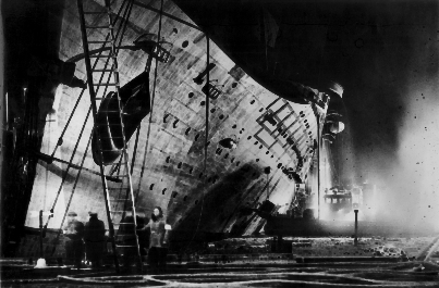
We’re the United States Navy SO FUCK YOU!!!

Yup sounds about right

[QUOTE=Jeffrox;95591]I’ve navigated in SE Asia for decades outside of shipping channels, and in the Sulu Sea more times than I can count , with zero mishaps. I’m not stupid but I am prudent. While there may be an errors on the digital chart (8 miles they say?) there is no such large errors on the paper chart, http://www.charts.noaa.gov/NGAViewer/92020.shtml . I agree with Kennebec Capt, one shouldn’t “test” the nat’s ass accuracy of any chart (unless it’s survey work you’re doing.)[/QUOTE]

Looking at the chart it does look safe to transit. Doesn’t look like a “local knowledge” area only. There is lots of deep water,I don’ t think I"d have a problem leaving the shipping channels either but for sure I’d want to check the pubs first unless I’d done the transit before.

Then the question is how far off hazards to lay the track… An 8 mile charting error is a very large one. I’ve not seen errors over 2 miles that I can recall. Many mariners would consider a track-line laid 6 miles off the reef to be safe one.

K.C.

There are two ways to “test a chart”, distance off which is not an issue in high traffic areas given a normal safe distance off, the other is UKC. (under keel clearance) which can be an issue in an area with an old survey depending upon the topography. In this case that is not an issue given the depths.

No it’s we are Americans we do not listen to anyone. I have seen two American ships going aground after being warned, in both cases the warning were just blown off.

[QUOTE=cappy208;95587]one of the early reports said a fillipino tug was on scene about 14 hours after. But, the Navy has to do it… Better.[/QUOTE]

Just what I suspected…so FUCKING typical of our great and glorious US Navee!

How much is a minesweeper worth? Probably $75M at the way our DoD spends money!

Some brasshat should loose his career just like the CO should for not allowing that tug to do the job right at the beginning when it had a good chance to save the GUARDIAN! It won’t happen tho, just the little fish will be sacrificed!

Lots of info here:

Digital Map Error May Have Led To Minesweeper Grounding; Conditions Worsen (updated)

The Digital Nautical Charts (DNC) used by the Guardian and most Navy ships are produced by the National Geospatial-Intelligence Agency (NGA), a largely secret organization headquartered in Springfield,Va.

The DNC charts come in several versions. “General” and “coastal” versions are used in open areas such as the Sulu Sea, and “approach” and “harbor” versions are used for operating in and around harbors. According to an NGA memo sent to the Navy on Jan. 18, the error was in the coastal DNC, apparently in use on board the Guardian at the time of the grounding.

The general DNC and hardcopy charts show the reef’s location correctly, NGA said.

Letitia Long, the agency’s director, told the Navy that the coastal DNC chart for the Sulu Sea would be corrected by Jan. 30, and advised ships not to use DNC coastal charts in the area until then.

The Navy’s head navigator took things a step further, advising in a message sent to the fleet Jan. 18 “to operate with caution when using NGA-supplied Coastal Digital Nautical Charts due to an identified error in the accuracy of charting in the Sulu Sea.”

Rear Adm. Jonathan White, Oceanographer and Navigator of the Navy, said in the message that preliminary analysis of the error indicates it “resulted from incorrect geographic rectification of satellite imagery used to build” the coastal DNC charts.

“NGA has found no other anomalies, but is currently conducting a comprehensive review of its source data,” White said in the message.

He cautioned Navy ships “to compare coastal DNC charts with general DNC library charts, and not rely on [a] single source for navigation data.

“Commanding officers,” White added, “are directed to report any anomalies immediately to NGA.”

The agency expects to complete its review of all coastal DNC charts by Jan. 22, White noted.

the Trabajador, also is on the scene and assisting,…The Vos Apollo, an anchor-handling ship from Singapore, is expected to arrive at Puerto Princessa early Monday …the Pearl Harbor-based salvage ship Salvor also is en route,

It sounds to me like failure to observe a lighthouse intended to mark this particular danger, failure to observe islets on the reef, failure to observe breakers on the reef, and failure to head the warnings of park rangers that the ship was standing into danger, are the true causes of this incident. I suspect that the alleged inaccuracy of electronic charts had very to do with this.

I’m not interested in scapegoats. I say let’s dock the pay of all admirals by 10% until the full cost of this incident is covered.

[QUOTE=ElCapitan;95345]Who has paper chart free wheel houses? Is there anyone besides our navy dumb enough to try that?[/QUOTE]

My company has a few vessels that have “paper free” wheel houses, where two completely independent ECDIS system are carried on the bridges. These vessels also carry a small paper folio of charts called “Take me home charts”, enough to get you a crude passage plan to safe port of call in worst case scenario.

ECDIS is a really great thing provided that it is being operated by well trained competent personnel and you are using a good approved make of ECDIS. Over the years there have been many many navigational incident due to paper charts, and I’m sure there will be many due to improper use of electronic system. With ECDIS it tends to be more down to people not being able to use it to it’s full advantage, people might tweak with the layers etc and mess it up by taking many features off it and not setting the contour alarms to the correct level.

A properly used ECDIS system has many advantage over paper charts, provided it is operated by competent personnel, using the great features of it like radar overlays which give you an immediate visual indication of your position rather than having to waste precious seconds putting on range and bearings.

If is this case the reef was actually not in the correct position on the electronic chart, then should the company that supplied the electronic chart not be liable?

[QUOTE=tugsailor;95641]It sounds to me like failure to observe a lighthouse intended to mark this particular danger, failure to observe islets on the reef, failure to observe breakers on the reef, and failure to head the warnings of park rangers that the ship was standing into danger, are the true causes of this incident. I suspect that the alleged inaccuracy of electronic charts had very to do with this.

I’m not interested in scapegoats. I say let’s dock the pay of all admirals by 10% until the full cost of this incident is covered.[/QUOTE]

It’d be tough to defend going up on the beach but there could be mitigating circumstances. For one it’s quite likely the light was out in that part of the world, Another possibility is rain showers, a squall line and rough seas might have made it very difficult to pick up a low-laying reef on radar.

It does look like there was an 8 mile error in the position of the reef. If the chart being used by the bridge team showed they were on track and the track passed clear of all hazards it’s likely they were confident they were on a safe track. Given the high level of reliability and ease of use of nav systems it’s likely that what ever contradictory information they may have had would have confused them rather then alerted them that something was wrong.

K.C.

[QUOTE=follow40;95666]If is this case the reef was actually not in the correct position on the electronic chart, then should the company that supplied the electronic chart not be liable?[/QUOTE]

That would be the great, glorious and grand USN! They are perfect at everything…just ask them!

Btw, WHY THE EFF DO WE HAVE ALL:THOSE EXPENSIVE T-AGS ANYWAY? WHAT FUCKING WASTE! LEAVE IT TO THE NAVEE!