


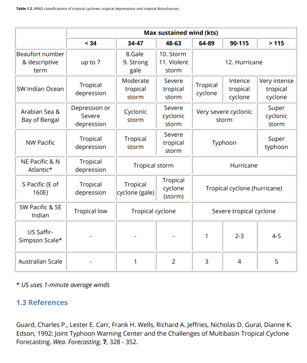
Can we walk for starters through all stages of development , transition and track of hypothetical tropical compact revolving low pressure system. As I can see all agree, that to be assigned name “tropical” it must form and transit initialy in tropical zone /subtropical zone irrespective of longitude.
It seems to me all agree that upon reaching required wind speed in the vicinity of it’s center it will be called:
a) hurricane
b) typhoon (Taifun)
c) cyclone
Above a) b) c) are refered to as per the publication WMO as " “tropical cyclones” . Or alternative maritime term : " tropical revolving storm"
Before reaching the state and acquiring it’s geographical name a), b) ,c) it’s stages of development are as follows:
- tropical wave
- tropical wave disturbance
- tropical depression - organised and with defined max
wind speed - tropical storm- moderate to severe organised , with
defined max wind speed
Items 1,2,3,4 have common/same names irrespective of longitude/geography.
The moment item 4) reaches wind force B>12 at its core it acquires names a) or b) or c)
So now let’s assume my ship is navigating in close proximity of a system a) b) c) . Weather maps and printed weather reports will describe the system with geographical name( or it’s abbreviation) and provide other details. Irrespective if I am sailning in gale force winds , storm force winds or B> 12 i will say/describe this sailing condition as " i am navigating in a) b) or c) depending on my longitude/geographical location in tropical/subtropical zone.
Before i continue transit from tropical /subtropical zone to temperate zone I want to ask all a question :
Do You all agree with above? . If not pls comment .
10.12.24 late pm
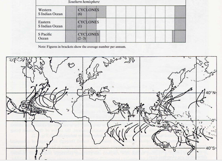
From Global Guide to tropical cyclone forecasting
Have figured may be I can give the whole book to those weather buffs who kept this thread going as a gesture of appreciation.
More to come