Thanks for posting those photos capt. Reads like an incredible journey you are on, and fortunately able to enjoy it somewhat leaving the stresses associated with the job to someone else for a change.
[QUOTE=cmakin;179504]Thanks. That is a part of the world that I have not been to as yet. A couple of years ago, the company I was working for handled a claim down there, unfortunately, I did not get the assignment. . .[/QUOTE]
Crankshaft ? Ahem. 2nd time too…
A few more images.
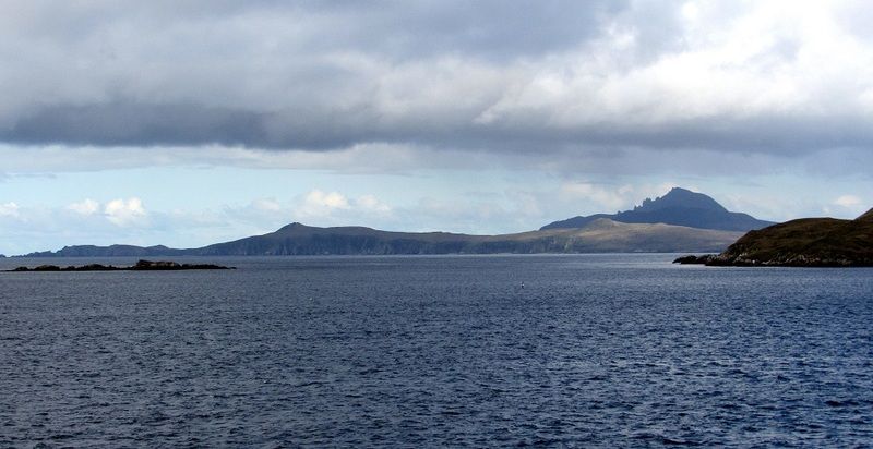
Cape Horn as seen heading north through the Wollaston Islands.
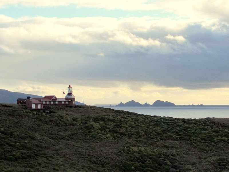
Cape Horn light with Cape Deceit in the background.
just to give everybody an idea of the geography of the place but what would actually be “The Cape” we speak of is in fact “False Cape Horn” and that which is the “true Cape” is really the southernmost of a small group of islands which comprise the Hermite and Wollaston Groups. So really when you round “The Horn” you’re just going by a rock however the winds, seas and the currents that sweep past that “Rock” make it one of the worst places on earth for the mariner whether under sail or power!
from Wikipedia
Several factors combine to make the passage around Cape Horn one of the most hazardous shipping routes in the world: the fierce sailing conditions prevalent in the Southern Ocean generally; the geography of the passage south of the Horn; and the extreme southern latitude of the Horn, at 56° south. (For comparison, Cape Agulhas at the southern tip of Africa is at 35° south; Stewart Island/Rakiura at the south end of New Zealand is 47° south.)
The prevailing winds in latitudes below 40° south can blow from west to east around the world almost uninterrupted by land, giving rise to the “roaring forties” and the even more wild “furious fifties” and “screaming sixties”. These winds are hazardous enough that ships traveling east would tend to stay in the northern part of the forties (i.e. not far below 40° south latitude); however, rounding Cape Horn requires ships to press south to 56° south latitude, well into the zone of fiercest winds.[18] These winds are exacerbated at the Horn by the funneling effect of the Andes and the Antarctic peninsula, which channel the winds into the relatively narrow Drake Passage.
The strong winds of the Southern Ocean give rise to correspondingly large waves; these waves can attain great height as they roll around the Southern Ocean, free of any interruption from land. At the Horn, however, these waves encounter an area of shallow water to the south of the Horn, which has the effect of making the waves shorter and steeper, greatly increasing the hazard to ships. If the strong eastward current through the Drake Passage encounters an opposing east wind, this can have the effect of further building up the waves.[19] In addition to these “normal” waves, the area west of the Horn is particularly notorious for rogue waves, which can attain heights of up to 30 metres (100 ft).
The prevailing winds and currents create particular problems for vessels trying to round the Horn against them, i.e. from east to west. This was a particularly serious problem for traditional sailing ships, which could make very little headway against the wind at the best of times;[21] modern sailing boats are significantly more efficient to windward and can more reliably make a westward passage of the Horn, as they do in the Global Challenge race.
Ice is a hazard to sailors venturing far below 40° south. Although the ice limit dips south around the horn, icebergs are a significant hazard for vessels in the area. In the South Pacific in February (summer in Southern Hemisphere), icebergs are generally confined to below 50° south; but in August the iceberg hazard can extend north of 40° south. Even in February, the Horn is well below the latitude of the iceberg limit.[22] These hazards have made the Horn notorious as perhaps the most dangerous ship passage in the world; many ships were wrecked, and many sailors died attempting to round the Cape.

My personal favorite. Watch out for those Fuegian pirates.
Man, this is a Trip of a Lifetime! The weather looks like it behaving and I hope that you are enjoying yourself.
Please keep the pictures coming so those of us that will never make down there can dream of making this trip ourselves.
[QUOTE=+A465B;179690]Crankshaft ? Ahem. 2nd time too…[/QUOTE]
No, not a maritime claim. . . something to do with a platform. . . all of the crankshaft claims I dealt with were in the Caribbean. . . across a few different islands, but oddly enough, the same ship. . .
Heading out to the airport at Punta Arenas for the long trip back home to “Gringolandia”. But, before I go, I wanted to post a couple of shots of one of the most interesting things I have seen this trip.
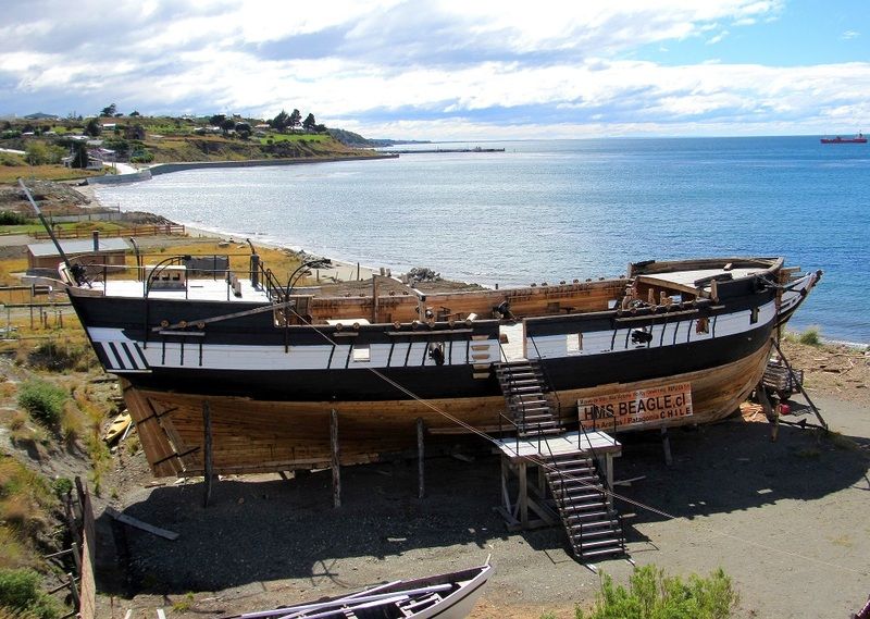
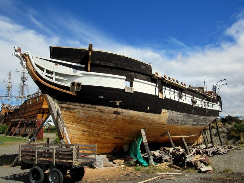
Spent a few hours out at the Museo Nao Victoria, just east of Punta Arenas on the Magellan Strait.
The owner is constructing a replica of Beagle. Beagle will join his other works of art at his museum.
I don’t have a link, but look up Museo Nao Victoria and read the story for yourself.
Some fantastic stuff…
I’ve got a ton of images to edit when I return home and I’ll see what I can do about setting up a gallery if anyone is interested in viewing them.
See you back in the states and thanks for the kind words and enthusiasm displayed in what has been the voyage of a lifetime for me.
[QUOTE=capnfab;179785]
I’ve got a ton of images to edit when I return home and I’ll see what I can do about setting up a gallery if anyone is interested in viewing them.
[/QUOTE]
Yes, please do!


